Forests, History, and Culture in Adjara
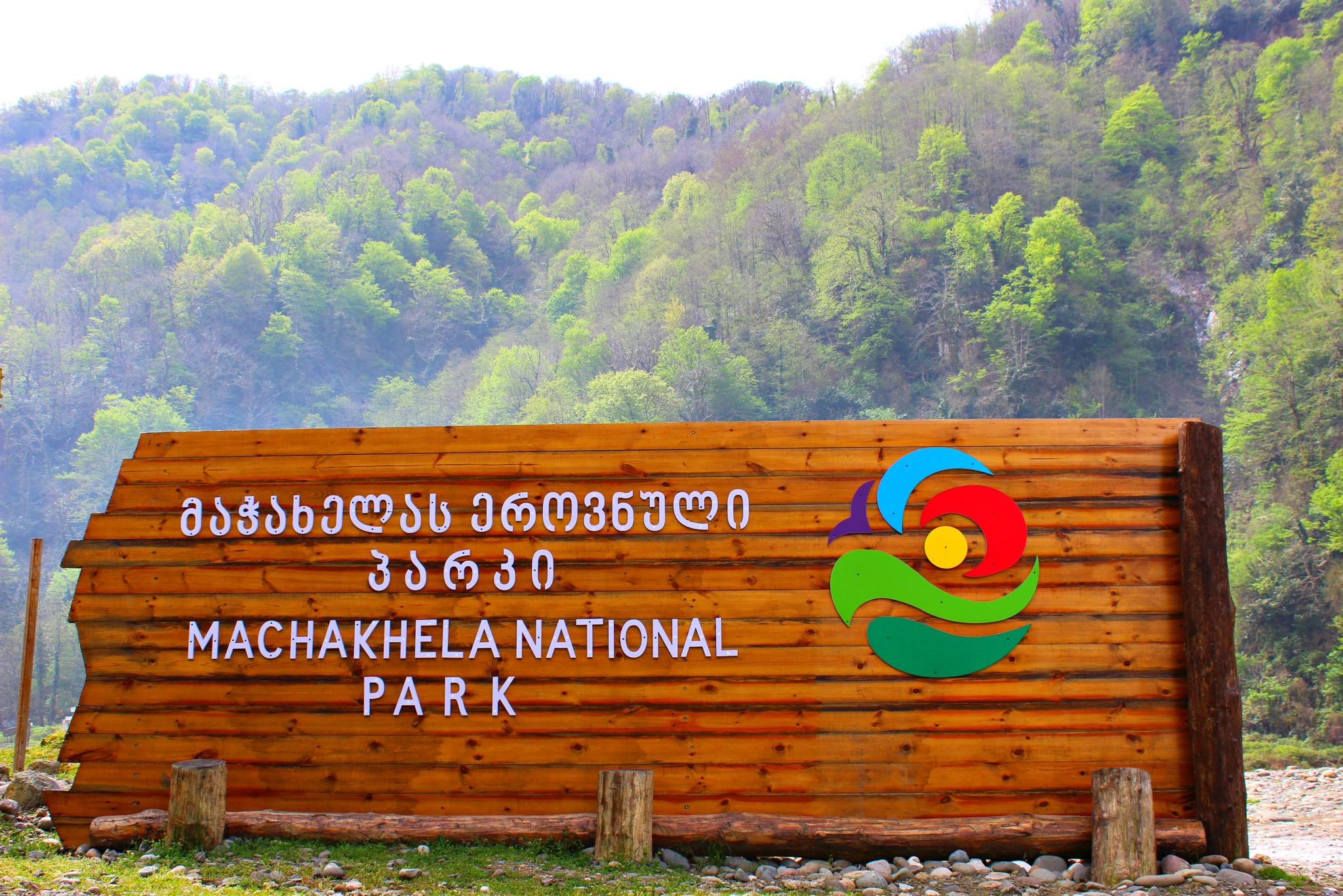
Welcome to Machakhela National Park, a beautiful protected area nestled in the green mountains of Adjara, in the southwestern corner of Georgia, near the border with Turkey. Located relatively close to the Black Sea city of Batumi, this park offers a wonderful blend of stunning natural landscapes, rich forests teeming with life, and the unique local history and culture of the Machakhela Valley.
UNESCO World Heritage Site
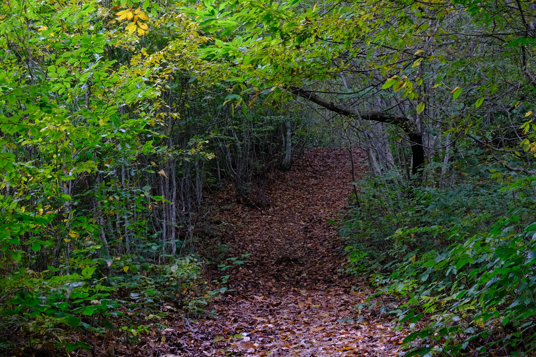
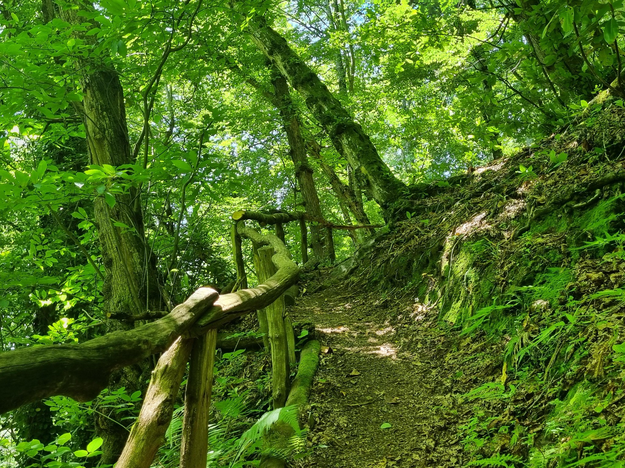
Established as a national park in 2012, Machakhela aims to protect its special Colchic forests that stretch across the slopes of its mountains. These are an ancient type of forest, similar to rainforests due to the very humid climate here, filled with a diverse range of trees, shrubs, and flowers. They are so important that the park is included as part of the UNESCO World Heritage Site “Colchic Rainforests and Wetlands.” Walking here is like entering a vibrant, green world, where you’ll find tall beech and chestnut trees, a dense understory of evergreen shrubs like cherry laurel and rhododendron, and mosses covering rocks and tree branches. The park is home to various animals, including roe deer, wild boar, brown bear, lynx, and many species of birds and amphibians, such as the Caucasian salamander.
A Valley of History and Craftsmanship
But Machakhela is not just about nature. The valley has a fascinating history. For centuries, it was known throughout the region for its highly skilled gunsmiths who produced special rifles called “Machakhela.” Although this craft no longer exists today, you can learn about this history at the local museum in the village of Zeda Chkhutuneti or see the Machakhela Gun Monument. Another sign of the valley’s history are the beautiful old stone arch bridges that cross the rivers and streams – some of them dating back to the Middle Ages.
A Journey Through Nature and Culture
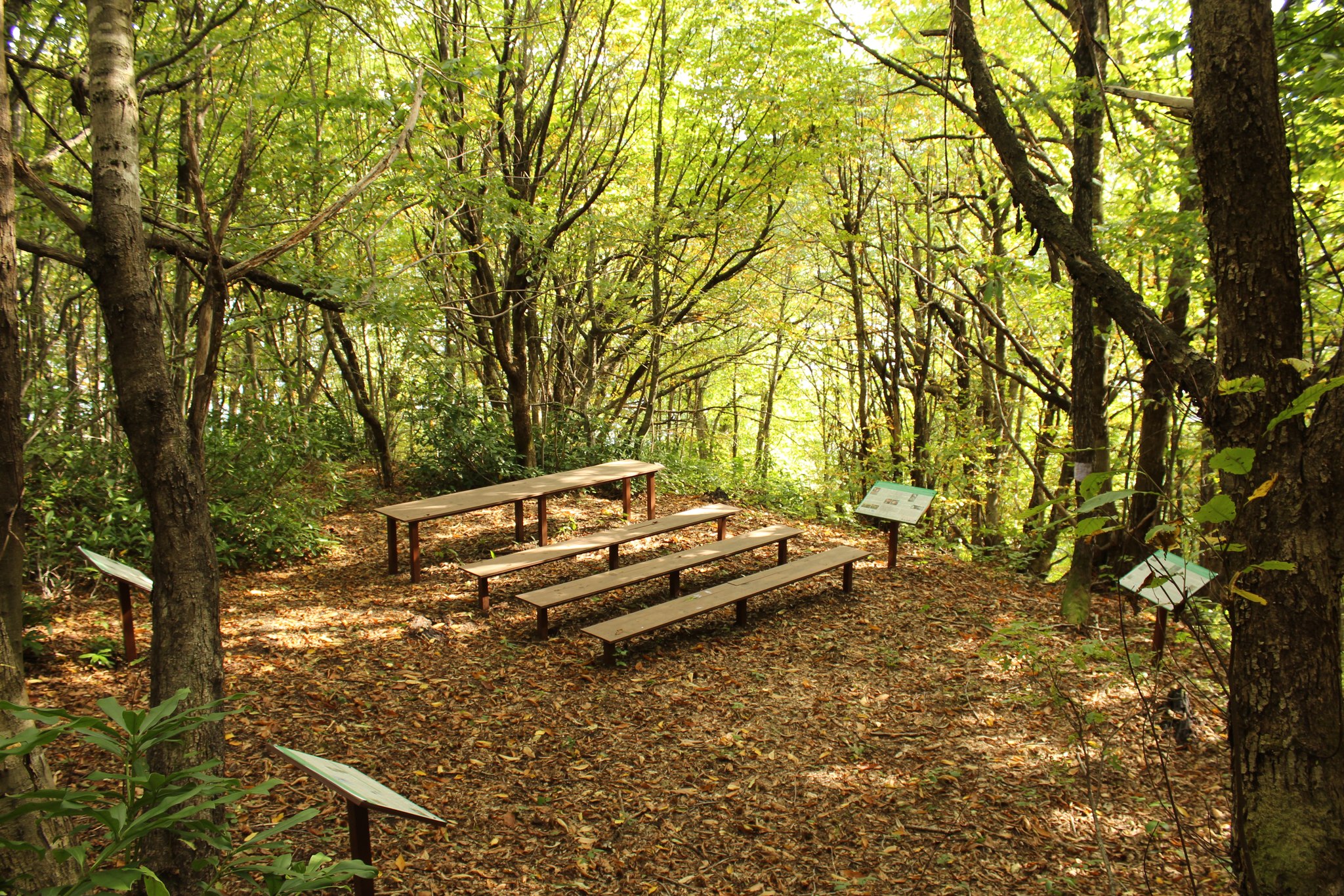
Visitors to Machakhela National Park can explore its nature and culture via marked hiking trails. These trails will lead you through beautiful forests, past waterfalls, to viewpoints with stunning panoramas of the valley and mountains, and connect traditional Adjarian villages where local life continues. Staying at a guesthouse in one of these villages is an excellent way to experience local hospitality and taste traditional Adjarian dishes.
Easily accessible from Batumi, Machakhela National Park offers a delightful experience for those seeking a combination of lush Colchic nature, unique local history, and authentic culture in a beautiful mountain valley setting. Remember to respect both nature and local traditions during your visit.
Park Overview
Official Name:
Machakhela National Park.
Protected Area Type:
National Park (IUCN Category II). Protects natural ecosystems and cultural landscapes, allowing for compatible tourism and education.
Date of Establishment:
2012.
Governing Body:
Agency of Protected Areas of Georgia (APA).
How to get to Machakhela National Park?
Geographic Location:
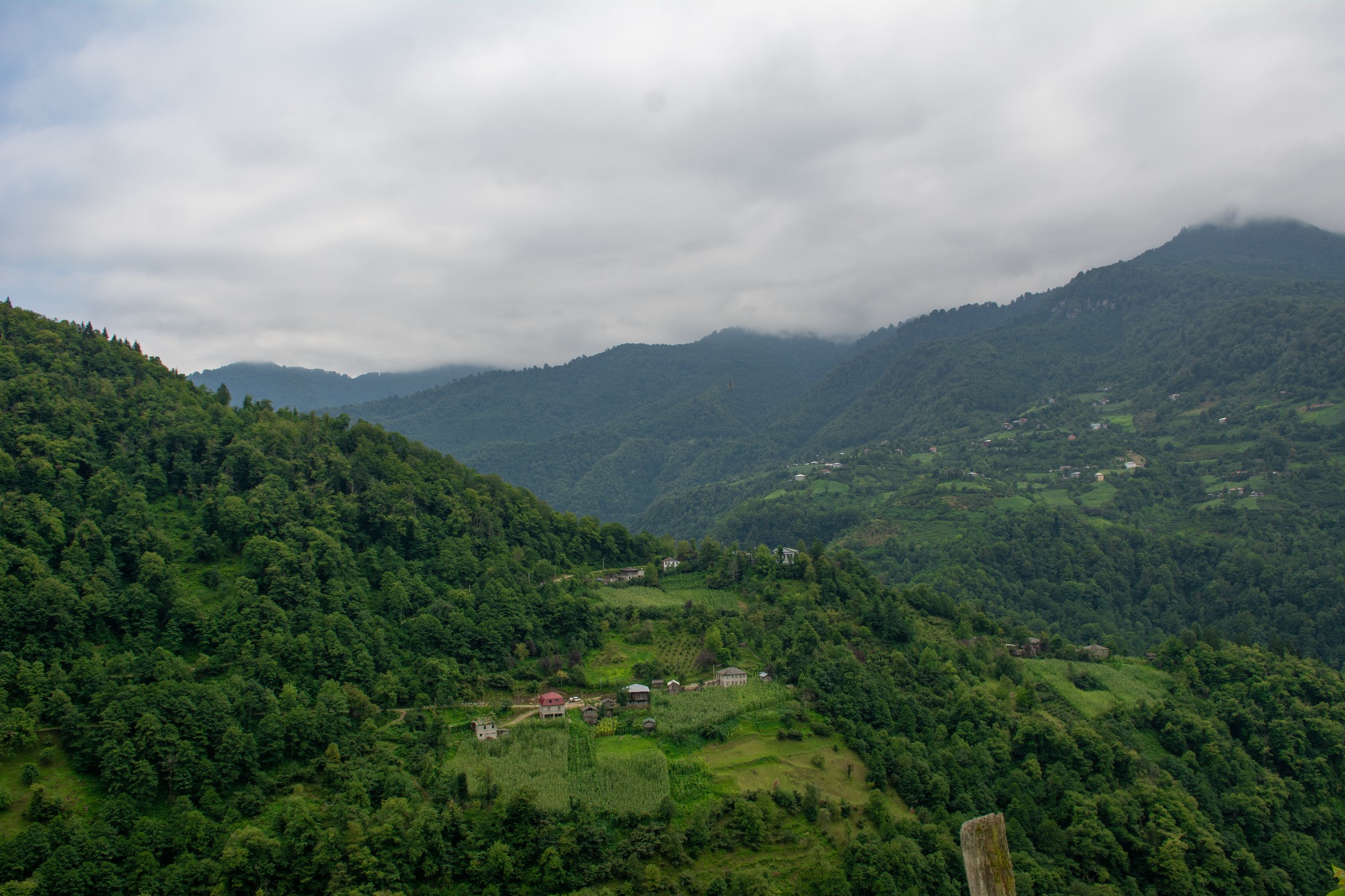
Georgia, Autonomous Republic of Adjara, Khelvachauri Municipality. Located in the Machakhela river valley and surrounding mountains (Adjara Range, Lesser Caucasus), bordering Turkey.
Map/Coordinates:
Approximately 41°30′ North latitude, 41°50′ East longitude. Maps are available from the visitor center or the APA website.
Nearest Cities/Settlements:
Batumi (main city) is approximately 30-40 km away. The town of Khelvachauri is nearby. The park’s visitor center is in the village of Acharisagmarti. The main villages in the valley are Zeda Chkhutuneti and Kveda Chkhutuneti.
How to get there:
- By Car/Taxi: From Batumi, drive south towards Khelvachauri/Sarpi (Turkish border), then turn inland towards the Machakhela Valley to the village of Acharisagmarti (visitor center). Road conditions deeper in the valley can be variable, with some parts being unpaved or narrow, requiring caution. Check local conditions.
- Public Transport: Minibuses (marshrutkas) may run from Batumi to the villages of the Machakhela Valley (e.g., towards Zeda Chkhutuneti), potentially passing the visitor center or trailheads. Frequencies may be limited; check schedules locally in Batumi.
Nearest Airport:
Batumi International Airport (BUS).
Park Landscape and Geography
Area:
Approximately 8,733 hectares (87.33 km²).
Topography:
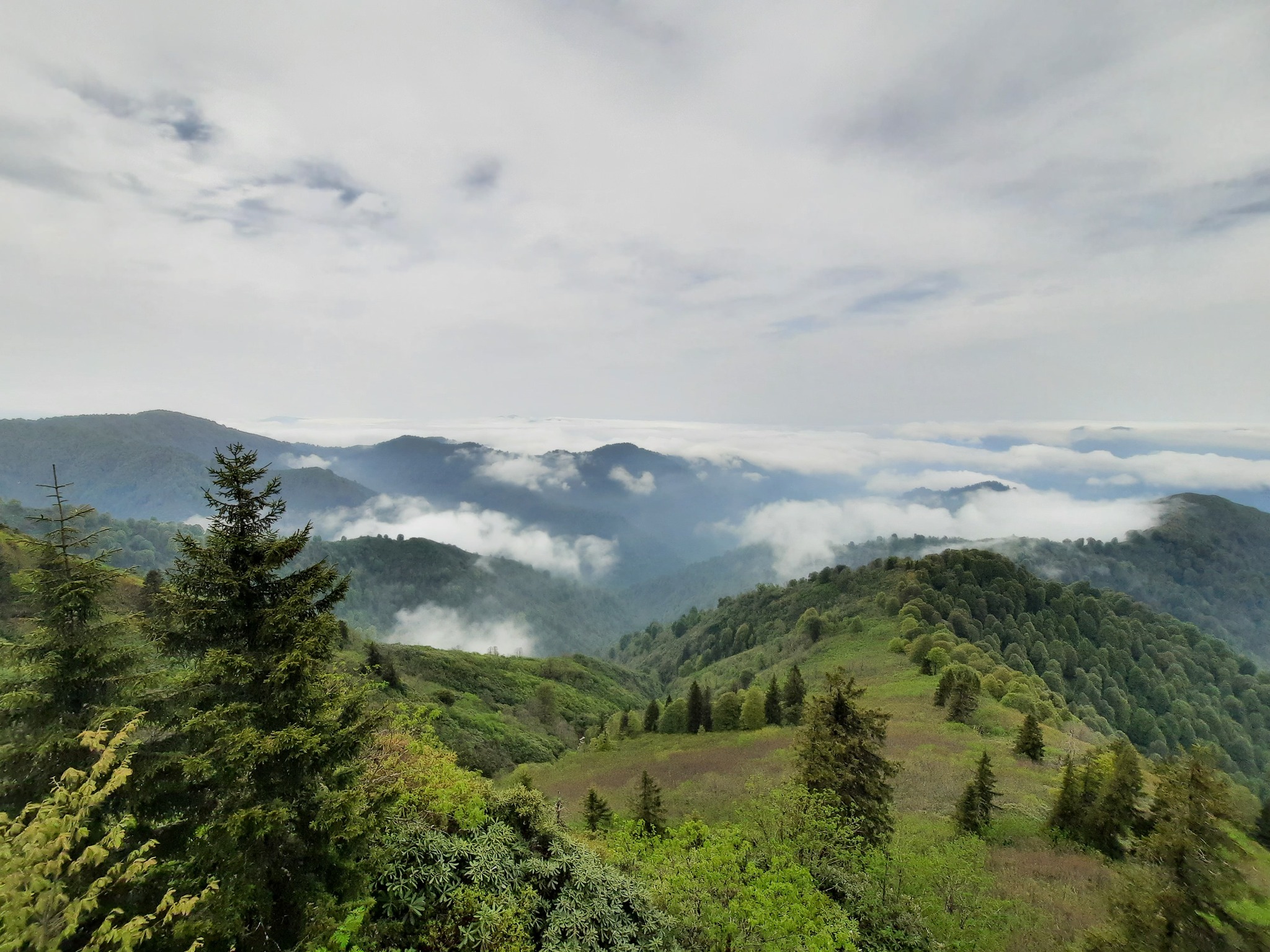
Mountainous landscape of the Adjara Range (Western Lesser Caucasus). Steep slopes, a deep Machakhela river valley/canyon, forests. Elevation ranges from about 300-400 meters on the valley floor to 1300-1400 meters on the surrounding ridges.
Geology and Key Features:
Geology of the mountain system. Key features include the Machakhela Valley, dense Colchic forests, waterfalls, rivers, cultural monuments (arch bridges, historical gunsmithing sites). Mt. Mtavarangelozi offers views.
Hydrology:
Dominated by the Machakhela River (Machakhlistskali) and its tributaries. Numerous streams and small waterfalls. High rainfall feeds the river system.
Climate:
Humid subtropical climate, characteristic of Adjara’s inland valleys near the coast. High humidity and significant rainfall throughout the year. Mild winters (snow mostly at higher elevations), warm/hot and humid summers. Good for visiting from spring to autumn, but rain can be expected at any time.
Why is Machakhela Park Important?
Reason for Establishment:
To protect the unique Colchic forest ecosystems and biodiversity of the Machakhela Valley. To conserve the cultural heritage associated with the valley (arch bridges, gunsmithing history). To promote sustainable ecotourism and support local communities. Potential for transboundary cooperation with Turkey (bordering Jamili Biosphere Reserve).
Key Values:
Rich biodiversity of the Colchic forest. Unique cultural heritage of the Machakhela Valley. Scenic beauty of the valley and mountains. Potential for ecotourism and cultural tourism. Transboundary ecological corridor.
International Recognition:
- Component of the UNESCO World Heritage Site “Colchic Rainforests and Wetlands.”
- Part of the Caucasus Biodiversity Hotspot.
- Borders Turkey’s Camili Efeler Forest Biosphere Reserve, creating potential for a transboundary protected area.
- Likely a member of the Emerald Network.
Flora and Fauna: The Park’s Natural World
Ecosystems/Habitats:
Colchic broadleaf forests (deciduous forests with a rich evergreen understory). Riparian habitats.
Key Plant Species:
Dominated by beech, chestnut, hornbeam, linden, alder. Rich evergreen understory (cherry laurel, Pontic rhododendron, holly, Colchic ivy). Relict species like yew and Colchic boxwood are found. Ferns and mosses are abundant. Diverse wildflowers.
Key Animal Species:
- Mammals: Brown bear, wolf, lynx, roe deer, wild boar, badger, marten, otter, Caucasian squirrel. Diverse bat populations.
- Birds: Forest birds are common (woodpeckers, flycatchers, thrushes, warblers). Predators include goshawk, sparrowhawk. Booted eagle or long-legged buzzard may be seen.
- Amphibians/Reptiles: Caucasian salamander, Caucasian viper, various frogs, lizards.
Endangered/Rare Species:
Brown bear, lynx, and otter are protected. The Caucasian salamander is vulnerable. Relict plants like yew and boxwood are of conservation concern. The Colchic forest ecosystem itself is recognized as valuable by its UNESCO status.
Useful Information for Visitors
Visitor Center:
Yes, located in the village of Acharisagmarti, Khelvachauri Municipality. Offers information, maps, exhibits on nature and culture, contacts for guides and guesthouses. Contact information on the APA website.
Opening Hours and Seasons:
The visitor center operates during business hours (check with APA). The park is accessible year-round, but the best seasons for hiking are late spring, summer, and autumn (approx. May-October) due to weather. Rain is expected at any time.
Entry Fees and Permits:
Check the current policy with the APA. Typically, entry to the national park may be free, but fees might apply for specific services (guides, possibly some trails/sites). Border zone permits may be required for hiking very close to the Turkish border; inquire at the visitor center or with Border Police.
Trails and Routes:
Several marked trails are available, often combining nature and cultural sites:
- Arch Bridges Trail (visiting historic stone arch bridges).
- Kokoleti Trail (through forests).
- Mt. Mtavarangelozi Viewpoint Trail.
- Trails connecting villages or leading to waterfalls/viewpoints.
- Difficulty ranges from easy walks to moderate hikes.
Activities:
Hiking, cultural tourism (visiting villages, arch bridges, the Machakhela gun monument, ethnographic museum in Z. Chkhutuneti), bird watching, nature photography, educational tours, possibly tasting local honey/products.
Accommodation:
- Inside the Park: Official park shelters are not typically available. Camping is possible in designated/agreed-upon areas.
- Nearby: A network of guesthouses exists in the villages of the Machakhela Valley (e.g., Zeda Chkhutuneti, Kveda Chkhutuneti, Skurdidi). They offer local hospitality and meals. Booking in advance is recommended. More options are available in Khelvachauri and Batumi.
Infrastructure:
Visitor center, marked trails, information boards, picnic areas. Guesthouses offer basic facilities. Toilets at the visitor center/guesthouses. Water from springs/streams (treatment recommended). Limited shops in the villages.
Safety Tips:
Be prepared for potentially wet/muddy trails. Waterproof gear is recommended. Roads in the valley can be narrow; drive carefully. Inform the visitor center/guesthouse of your hiking plans. Be aware of wildlife (bears). Mobile phone service may be limited. Obtain border permits if necessary and follow regulations. Check local advice on trail conditions.
Rules of Conduct in the Park Area
Code of Conduct:
Respect local culture and traditions. Follow “Leave No Trace” principles. Stay on the trails. Carry your trash back. Do not disturb wildlife.
Prohibitions:
Hunting is forbidden. Fishing regulations apply. Do not damage cultural monuments (bridges, etc.). Lighting fires only in designated safe areas (if permitted). Do not litter. Use of drones likely requires a permit. Strictly adhere to border zone rules.
Conservation and Management
Governing Body:
Machakhela National Park Administration (under the APA), likely based at the visitor center. Rangers patrol the area.
Conservation Efforts:
Protection of Colchic forest habitats and biodiversity. Monitoring of key species. Close cooperation with local communities to integrate conservation and sustainable livelihoods (e.g., tourism, traditional products). Protection measures for cultural heritage (arch bridges). Trail maintenance. Discussion of transboundary cooperation with Turkey. Fulfilling the management requirements of the UNESCO site.
Threats/Challenges:
Balancing the growth of tourism with conservation. Risks of illegal logging or poaching. Maintaining infrastructure in a humid climate. Ensuring economic benefits for local communities. Potential impacts of land-use changes or infrastructure outside park boundaries. Managing issues related to the proximity of the border.
Historical and Cultural Heritage
Brief History:
The Machakhela Valley has a long history. It became particularly famous from the 18th to the early 20th century as a center for the production of high-quality firearms, the “Machakhela” rifles. The border established in the early Soviet period divided the valley and its communities between Georgia and Turkey. The national park was established in 2012 to protect its natural and cultural value.
Cultural Significance:
High cultural value. A unique historical center of gunsmithing in Georgia. Several well-preserved medieval stone arch bridges (e.g., Tskhemlara bridge). Villages preserve traditional Adjarian traditions, music, and cuisine. The ethnographic museum in Zeda Chkhutuneti showcases local history and artifacts. Part of the UNESCO Colchic Rainforests and Wetlands World Heritage Site.
Interesting Facts about Machakhela
Unique Features:
- A unique combination of Colchic biodiversity and a specific cultural history (gunsmithing).
- Part of a potential transboundary protected area with Turkey.
- Located in the picturesque Machakhela Valley in Adjara.
- Included on the UNESCO World Heritage list.
- A relatively newly established national park.
Leave a review