Khulo: Embracing the Peaks of Adjara
Nestled in the high mountainous part of Georgia’s autonomous republic of Adjara, Khulo Municipality is a region of dramatic landscapes, rich cultural traditions, and a strong sense of community. Situated in the upper reaches of the Acharistsqali river valley, Khulo offers visitors a glimpse into authentic Adjarian mountain life.
Overview
Khulo Municipality is an administrative district in upper Adjara. It is characterized by its rugged mountainous terrain, diverse flora and fauna, and historical monuments scattered throughout its valleys and hillsides. The administrative center is the townlet (daba) of Khulo, a small but significant hub for the surrounding rural communities. The municipality is known for its unique cable car connecting Khulo to the village of Tago, a vital link for local residents.
Geographical Location
Khulo Municipality is located in the eastern part of the Adjara Autonomous Republic. It is bordered by Turkey to the south, Shuakhevi Municipality to the west, Keda Municipality to the southwest, and municipalities from other Georgian regions to the north (Chokhatauri and Ozurgeti in Guria) and east (Adigeni in Samtskhe-Javakheti). The municipality lies within the Meskheti and Arsiani mountain ranges, with elevations varying significantly across its territory, reaching up to 3,007 meters at Mount Kanli. The Acharistsqali river is the main waterway carving through the landscape, fed by numerous tributaries. Khulo’s geography is also marked by picturesque lakes, such as the Green Lake and Shuamta Lakes, and is home to parts of protected areas, showcasing its rich biodiversity.
History
The history of Khulo is closely tied to its location on ancient trade routes, particularly the one connecting Samtskhe-Javakheti with the Black Sea coast via the Goderdzi Pass. The name “Khulo” is believed to derive from “Khula,” meaning “trading house,” highlighting its historical role as a commercial point. In the medieval period, the region was significant, as evidenced by the numerous fortresses, churches, and bridges that survive today, such as the Khikhani Fortress and the Skhalta Monastery. During the Ottoman period, Khulo became an important center in upper Adjara. The region became part of the Russian Empire in the late 19th century and later part of Soviet Georgia. The modern administrative boundaries of Khulo District were established in 1965, later becoming Khulo Municipality. The area has faced challenges throughout its history, including the impact of political changes and natural disasters, which have influenced migration patterns from its mountainous villages.
Population
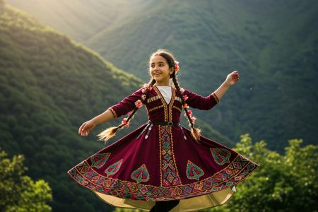
Based on the 2020 estimates, the population of Khulo Municipality is approximately 35,520. The population is primarily rural, with the majority residing in villages scattered throughout the mountainous terrain. The townlet of Khulo itself has a smaller population. The ethnic composition is predominantly Georgian. In terms of religious affiliation, the population is largely composed of Muslim Georgians and Georgian Orthodox Christians, reflecting the historical and cultural dynamics of the Adjara region. The challenging geography and limited accessibility of some areas have contributed to specific demographic patterns and community structures.
Politics
Khulo Municipality is governed by local self-governing bodies. The Khulo Municipal Assembly (Sakrebulo) is the elected representative body responsible for local legislation and oversight. The executive branch is headed by the mayor, who is directly elected by the municipality’s residents.
Administrative Divisions
Khulo Municipality is administratively divided into one townlet (daba), which is Khulo, and 12 administrative units known as communities (temi). These communities encompass a total of 78 villages (sopeli). This administrative structure organizes the scattered settlements across the mountainous terrain, facilitating local governance and the delivery of services to the residents of this expansive and often challenging geographical area.