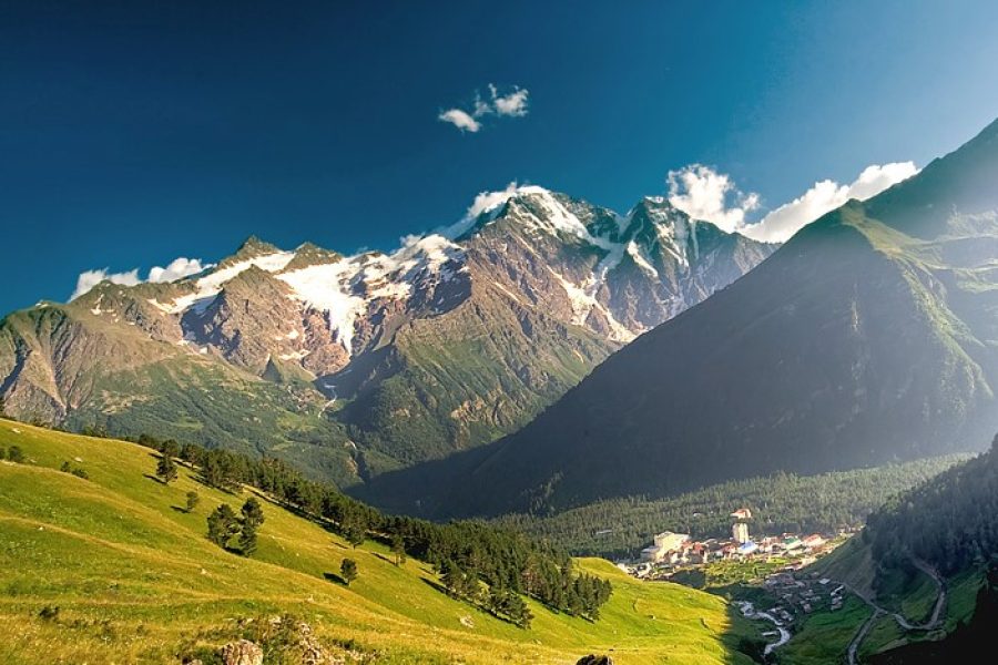
The Dolrachala River: A Glacial Beauty of Svaneti
The Dolrachala River (მდინარე დოლრაჭალა) is a high-altitude glacial river in the Mestia Municipality of Upper Svaneti, one of Georgia’s most stunning and iconic mountain regions. As a right tributary of the powerful Enguri River, the Dolrachala flows from the slopes of the mighty Svaneti Range, carrying the cold, milky waters of the region’s glaciers. The river carves a wild, beautiful valley through a landscape of towering peaks, alpine meadows, and pristine forests, embodying the raw wilderness of the High Caucasus.
The river is a key feature of the landscape for trekkers and mountaineers exploring the areas around Mestia. Its valley is home to several popular hiking routes, including those leading towards the Ushba Glacier and other high-altitude destinations. The Dolrachala is not just a river but a dynamic force of nature, constantly shaping the dramatic Svaneti landscape. Its confluence with the Mulkhura river before joining the Enguri is a powerful sight, showcasing the combined force of Svaneti’s mountain waters.
ℹ️ General Information
- Name of River: Dolrachala River (მდინარე დოლრაჭალა)
- Location: Mestia Municipality, Samegrelo-Zemo Svaneti, Georgia.
- Length: 13 km (8 miles)
- Basin Size: 116 km² (45 sq mi)
- Source (Origin): Glaciers on the southern slope of the Svaneti Range.
- Mouth (Where it flows): Joins the Mulkhura river, then flows into the Enguri River.
- Main Tributaries: Various glacial streams.
📍 Geography & Course
The Dolrachala is a classic glacial river. It begins high in the alpine zone, fed by meltwater from several glaciers. Its flow is turbulent and powerful, especially in the summer months. The water is characteristically opaque with “glacial milk”—fine rock particles ground by the ice. The river descends rapidly through a U-shaped glacial valley before joining the Mulkhura just north of Mestia.
🌿 Nature & Ecology
The river valley is a pristine high-mountain ecosystem. The upper reaches are dominated by alpine meadows, which are vibrant with wildflowers in the summer. Lower down, the slopes are covered with dense coniferous forests of fir and spruce, as well as birch groves. This habitat is a sanctuary for wildlife such as the Caucasian tur, chamois, and brown bears. The river’s cold waters support a population of trout.
🏛️ History & Culture
The river flows through the heart of Svaneti, a region with a unique and ancient culture. While the valley itself is sparsely populated, it is part of a landscape dotted with the famous Svaneti defensive towers. The river has been a part of the lives of the Svans for centuries, a source of water and a feature of the epic legends and folklore of this proud mountain people.
🚣 Activities & Tourism
- Trekking and Mountaineering: The Dolrachala valley is the gateway to some of Svaneti’s most popular and challenging trekking and climbing routes.
- Nature Photography: The dramatic scenery of the valley, with its glaciers, peaks, and rushing river, offers endless opportunities for photographers.
- Hiking: More accessible day hikes can be done in the lower parts of the valley from the Mestia area.
🛤️ Accessibility
The lower part of the Dolrachala valley is accessible from Mestia via local roads and trails. A 4×4 vehicle is necessary to get further up the valley. The area is best and most safely visited during the summer and early autumn trekking season (July-September).


Leave a review