Javakheti National Park: A Place with Lots of Lakes and Birds
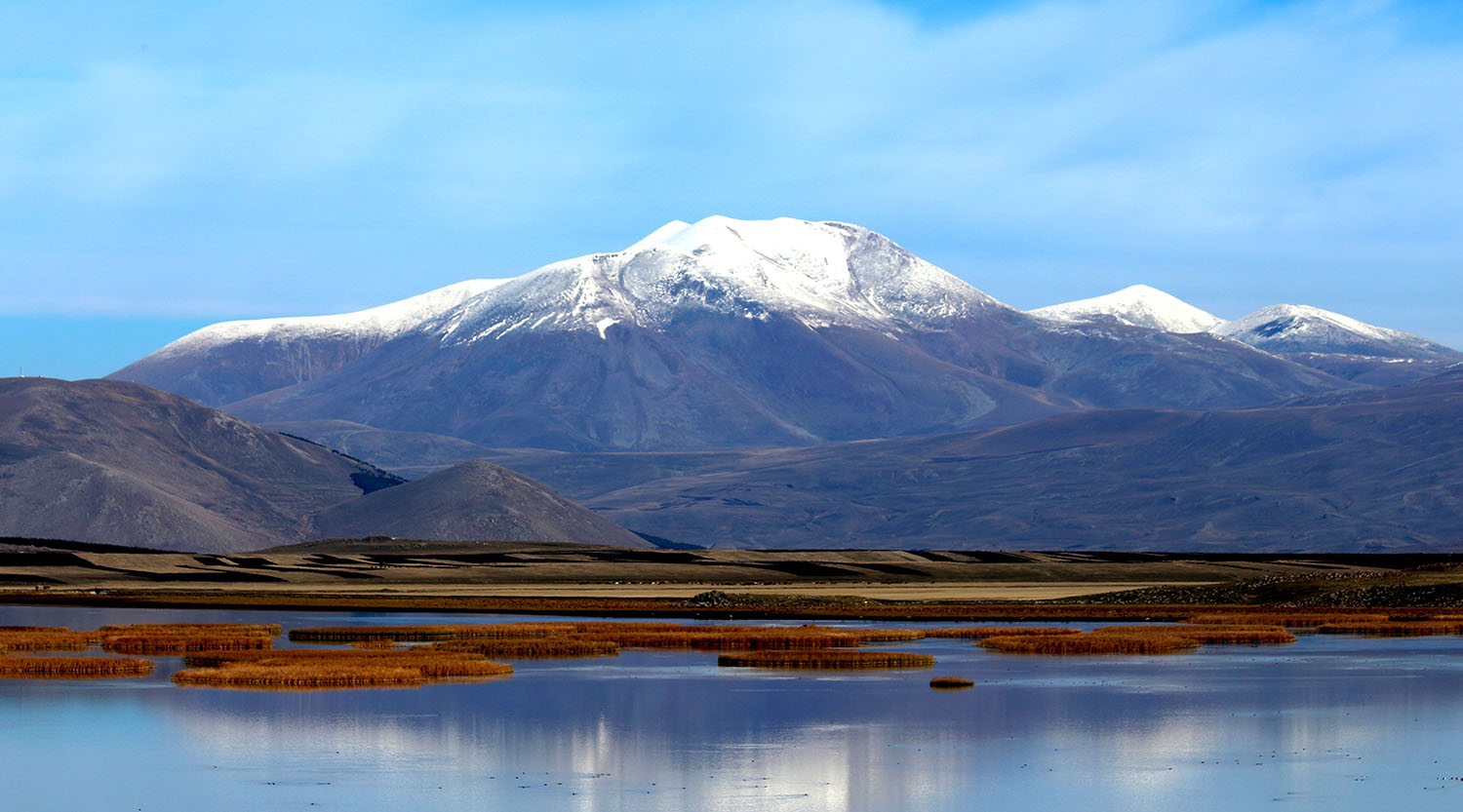
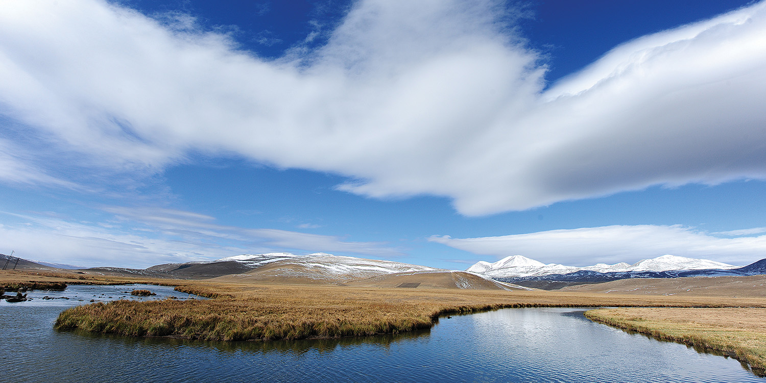
Welcome to Javakheti National Park, a one-of-a-kind and huge natural area in the south of Georgia, near the borders with Armenia and Turkey. It is on a high-altitude volcanic plateau. Javakheti has a very different landscape than many other Georgian parks. Instead of forest-covered mountains, it has wide-open grassy plains (steppes), rolling hills, and most importantly, many beautiful lakes and wetlands that shine under a big sky.
Georgia’s High-Altitude Wetlands
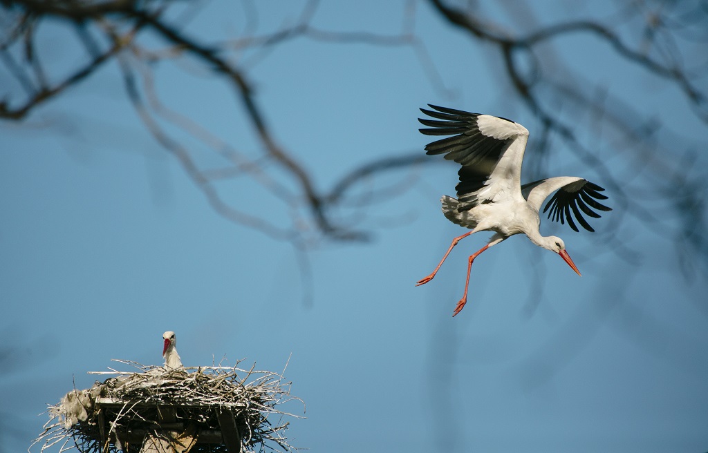
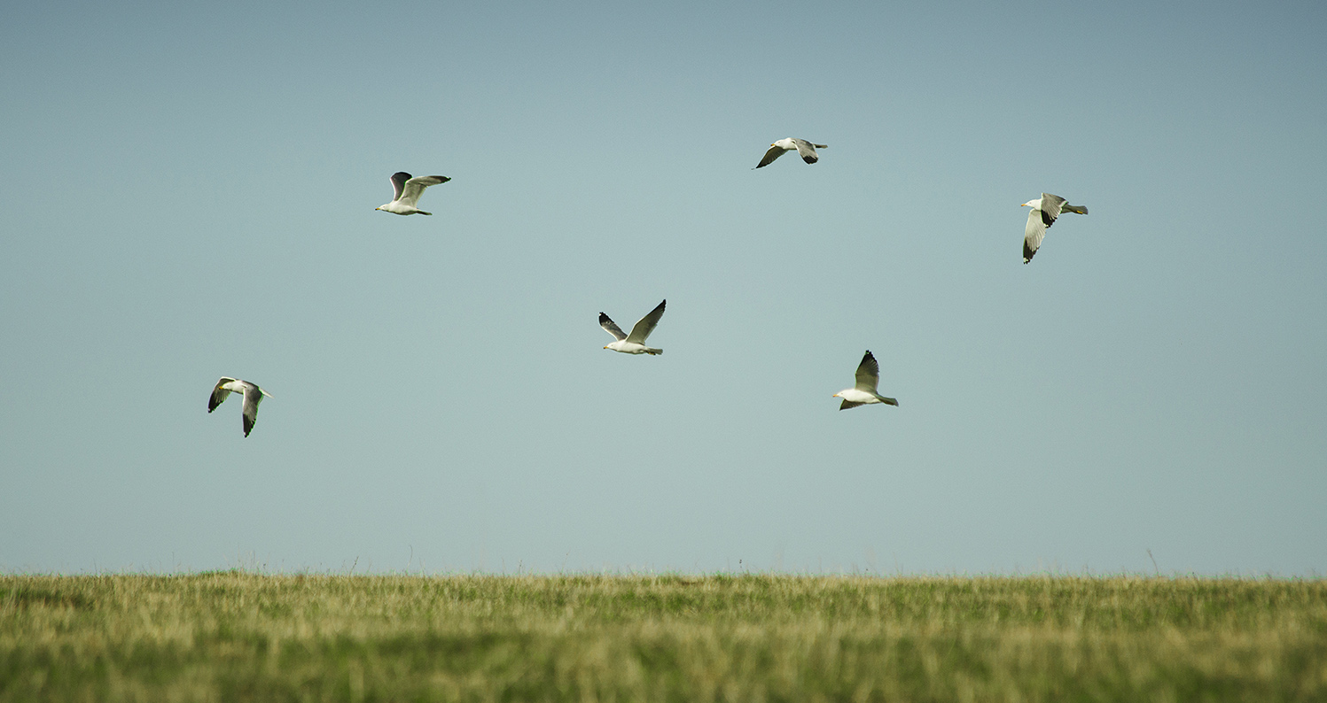
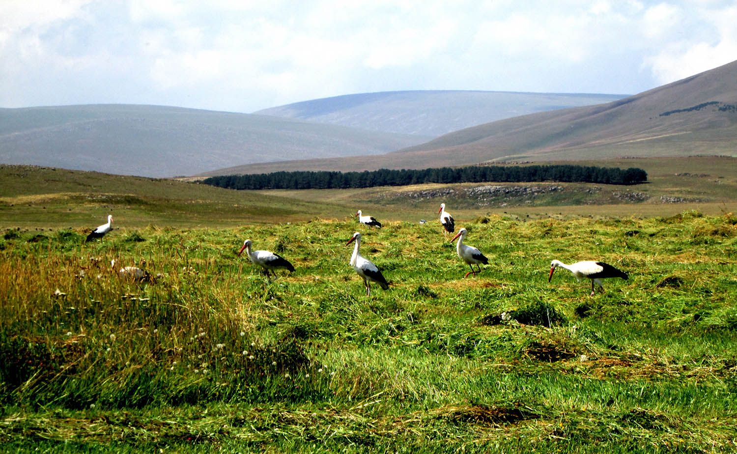
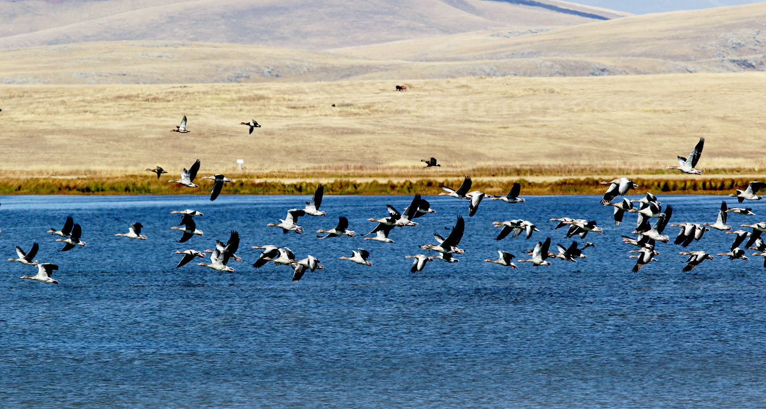
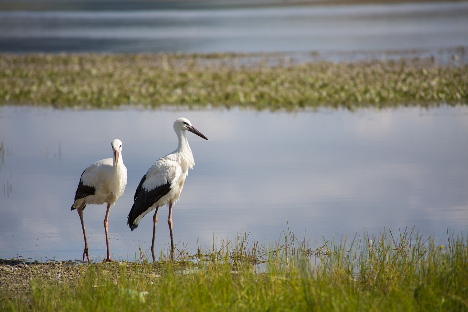
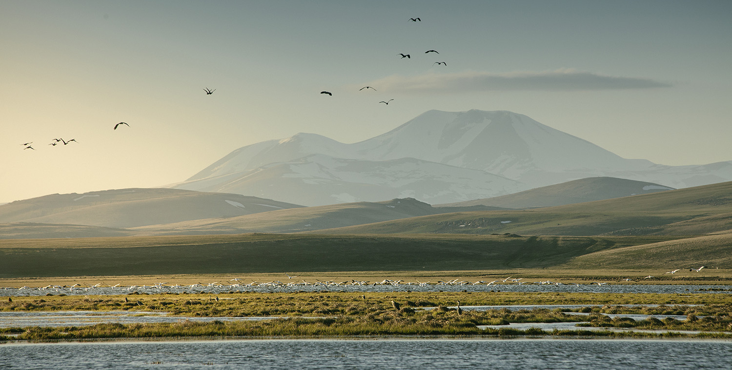
The main goal of this National Park, which was created in 2011 as part of the larger Javakheti Protected Areas system, is to protect these unique high-altitude ecosystems, which include grasslands, many lakes, and the amazing birdlife that depends on them. Birds love Javakheti, which is one of the most important areas in Georgia and even the world. The whole area is an Important Bird Area (IBA), and some of its lakes are Ramsar Wetlands of International Importance. This is a very important place for birds to breed, rest during migration, or spend the winter, especially water birds like ducks, geese, cranes, pelicans, and gulls.
Climate and Best Time to Visit
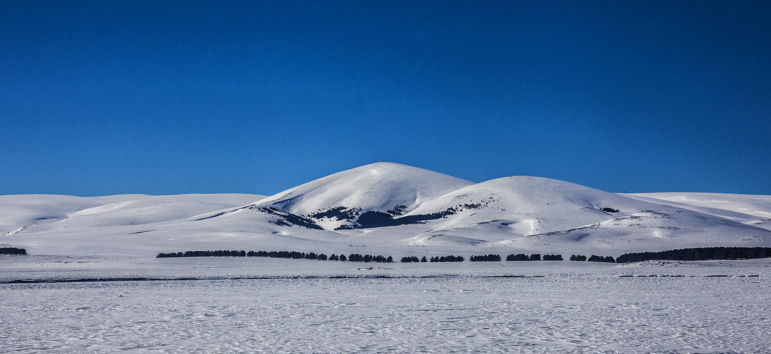
The average height of the Javakheti plateau is about 2,000 meters above sea level. Because it is so high up, the weather is very bad. Winter lasts a long time, is very cold, and has a lot of snow. It usually starts in October or November and ends in April or May. Summers are short, cool, and windy a lot of the time. Because of this, the best time to go to Javakheti National Park is usually from June to September, when the weather is nicer and there isn’t any snow on the roads.
Exploring the Plateau
To see the different lakes in Javakheti, you mostly have to travel across the plateau. Khanchali, Madatapa, Bugdasheni, Kartsakhi, and Sulda are some of the most famous lakes that are part of or near the protected areas. Lake Paravani, Georgia’s largest lake, is also in the area but not in the park itself. There are roads that connect these areas. Some are paved, and some are dirt tracks where a vehicle with more ground clearance might be better. Visitors can enjoy the breathtaking wide-open views, search for birds from designated viewpoints or towers near some lakes, have picnics, and take in the unique atmosphere of this high plateau.
There are Georgian, Armenian, and historically Doukhobor (a Russian spiritual group) communities living in towns and villages in Javakheti, such as Akhalkalaki, Ninotsminda, and Gorelovka. This makes the area culturally interesting as well.
Javakheti National Park is a unique and memorable place for birdwatchers and people who want to see wide, open landscapes that are very different from the rest of Georgia. This is especially true during the park’s short summer season.
Park Overview at a Glance
Official Name:
Javakheti National Park (ჯავახეთის ეროვნული პარკი). The Javakheti Protected Areas system includes this area as well as several lake Managed Reserves (Khanchali, Bugdasheni, Kartsakhi, Sulda, and Madatapa) and Natural Monuments.
Protected Area Type:
National Park (IUCN Category II) is a type of protected area that is surrounded by Managed Reserves (IUCN IV). Allows for controlled tourism while protecting ecosystems on high-altitude plateaus.
Established:
Established in 2011.
Managing Body:
The Agency of Protected Areas (APA) of Georgia is in charge.
Getting to Javakheti National Park
Location:
Samtskhe-Javakheti region in Georgia. In the municipalities of Ninotsminda and Akhalkalaki. It is on the Javakheti volcanic plateau, close to the borders with Armenia and Turkey.
Map/Coordinates:
About 41°08′ N, 43°40′ E. You need maps of the park and the nearby lake reserves to plan your trip. You can get them at the APA/visitor center.
Closest Cities/Towns:
Akhalkalaki and Ninotsminda are the two main towns in the area and the best places to get to. Akhaltsikhe is farther west.
How to Get There:
- By Car: It takes about three to four hours to drive from Tbilisi to Akhalkalaki or Ninotsminda. The main roads to these towns are paved. Roads that connect lakes or go through the park area may not be paved and may need vehicles with higher clearance, especially after bad weather.
- Public Transport: There are marshrutkas (minibuses) and buses that go from Tbilisi to Akhalkalaki and Ninotsminda. To get to certain parks or lakes from these towns, you need to take a local taxi.
Closest Airport:
The best airport in Georgia is Tbilisi (TBS), which is the closest.
Landscape and Geography
Area:
The area of Javakheti National Park is 16,209 hectares (162.09 km²). The Javakheti Protected Areas system, which includes the lake reserves, covers about 29,000 ha in total.
Topography:
The land is a high-altitude volcanic plateau that is about 2,000 to 2,200 meters above sea level. The area has mostly flat or gently rolling land, many shallow lakes, large wetlands, and huge steppe grasslands. You can see volcanic cones in the larger landscape, like Mt. Didi Abuli, which is about 3300 meters high.
Geology and Key Features:
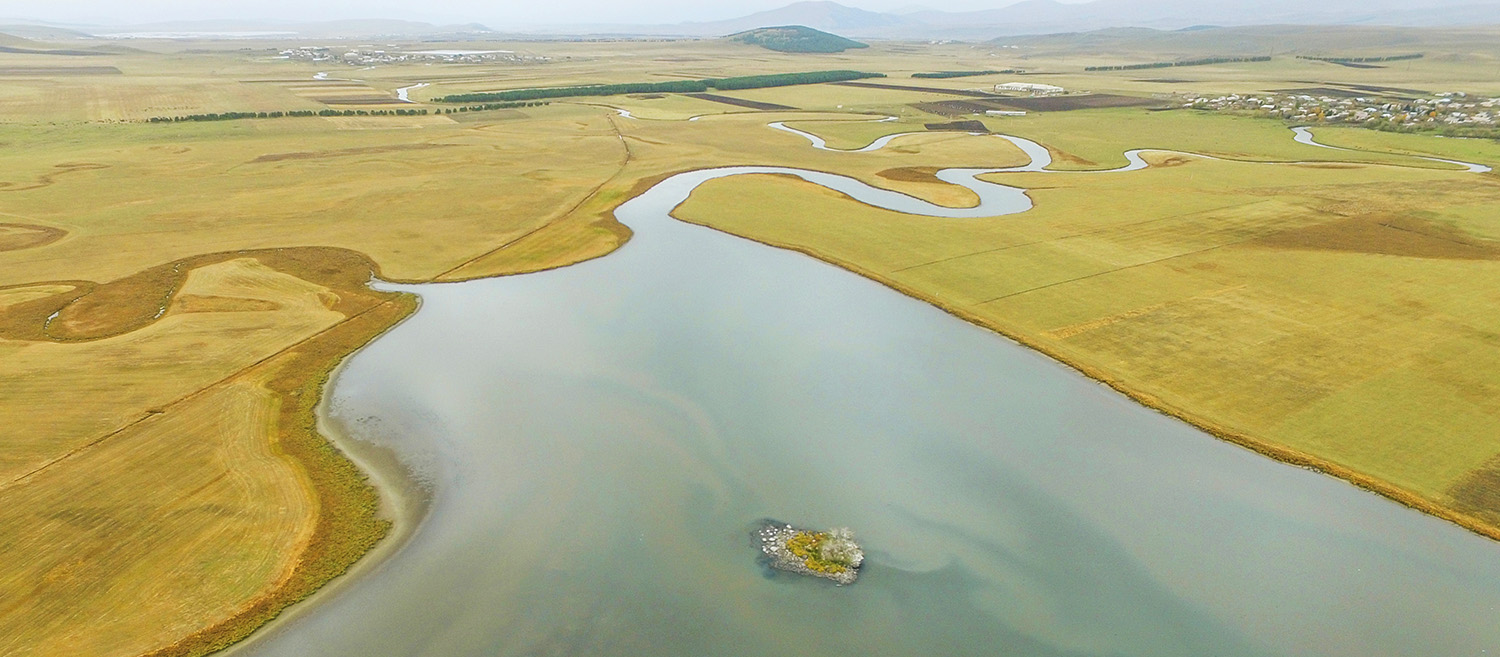
It was made by large flows of volcanic lava in the past. The many lakes (many of which are volcanic or tectonic), wetlands, steppe grasslands, and the high-altitude plateau itself are all important parts.
Hydrology:
There are many lakes in this area, such as Paravani (the largest in Georgia, outside of NP), Khanchali, Madatapa, Kartsakhi, Bugdasheni, and Sulda. Many lakes are surrounded by large marshes and wetlands. Lake Paravani is where the Paravani River starts.
Climate:
Very cold and dry in the mountains. Winters are very cold (temperatures can drop below -30°C), last a long time, and have a lot of snow (the snow cover can last until May). The summers are short, cool, dry, and often windy. It’s common for the temperature to be very different between day and night.
Why is Javakheti National Park Important?
Reason for Designation:
To protect the unique ecosystems of the Javakheti volcanic plateau, which has high-altitude steppes, many lakes, and wetlands. To protect the rich and important birdlife that lives in these habitats. To keep rare and native species safe. To help tourism that is good for the environment and focuses on birdwatching and enjoying the scenery.
Key Values:
A one-of-a-kind volcanic plateau landscape at a high altitude with lakes. Very important for birds that breed, migrate, and spend the winter (Ramsar sites, IBA). Biodiversity that is unique to the steppe and wetlands. There is a chance for scientific research and niche ecotourism, like birdwatching. Different cultures in the area.
International Recognition:
- A few lakes, like Kartsakhi, Bugdasheni, Khanchali, Madatapa, and Sulda, are Ramsar Wetlands of International Importance.
- The whole area is known as an Important Bird Area (IBA).
- A piece of the Emerald Network.
Flora and Fauna: The Park’s Natural World
Ecosystems and Habitats:
Alpine steppe grasslands, many freshwater and slightly brackish lakes, large marshes, fens, and wet meadows. There isn’t much natural forest cover, and there isn’t much on the plateau itself.
Key Plant Species:
There are many kinds of grasses and herbs that have adapted to the high-altitude steppe environment, such as Fescue and Feather Grass. Reeds, sedges, and cattails are common in wetlands. In early summer, colorful wildflowers bloom for a short time.
Key Animal Species:
- Birds: The most important biological feature. There are a lot of different kinds of birds, especially water birds. Important breeding ground for the Armenian Gull, the Ruddy Shelduck, and possibly the Common Crane. This is a key stopover and wintering place for a lot of birds, like the Dalmatian and Great White Pelicans, the White Stork, the Velvet Scoter, the White-winged Scoter, and many ducks (like the Pochards and Teal), geese, coots, and waders. Pallid Harrier, Montagu’s Harrier, Long-legged Buzzard, eagles, and falcons are all raptors. Larks and pipits are examples of steppe birds.
- Mammals: Common types are the wolf, red fox, European hare, several types of voles, and maybe even ground squirrels (sousliks). You can find European Otters near lakes and rivers. There aren’t many big animals like bears on the open plateau.
- Fish: Lakes have Carp, Crucian Carp, and maybe even Trout that were brought in by people in some places. Fishing is important in this area.
- Amphibians and Reptiles: There aren’t many different kinds because the climate is so bad. Some of the species that live in high altitudes are the Marsh Frog, the Moor Frog, some lizards, and maybe even vipers.
Endangered/Rare Species:
There are a lot of birds that need to be protected, like the Dalmatian Pelican (Near Threatened), the White-winged Scoter (Endangered), the Velvet Scoter (Vulnerable), and the Armenian Gull. It is thought that the high-altitude steppe ecosystem is itself at risk.
Planning Your Visit
Visitor Center:
Yes, there is a visitor center in the town of Akhalkalaki at 17 Nakhalaki St. Gives you information about the National Park and the nearby lake reserves, as well as maps, educational exhibits, and help finding local guides or guesthouses. Visit the APA website to find out how to get in touch and when they are open.
Hours and Seasons:
The visitor center is open during business hours (see APA). The best time to visit the park and the area around it is from June to September. From October or November to April or May, winters are very harsh, with deep snow that makes getting around very hard or impossible. It might be hard to drive on the roads until late spring.
Entrance Fees and Permits:
Check with the APA to see what the current rules are about entrance fees and permits. You might not have to pay to get in, but you might have to pay for certain services or to get into observation towers or platforms at lake reserves. You might need a permit to go to places that are very close to the Turkish or Armenian borders. You can find out more at the visitor center or the appropriate Border Police offices in Akhalkalaki or Ninotsminda. You need special permits to fish.
Trails and Routes:
There aren’t many marked hiking trails inside the National Park itself. Exploration usually means:
- Driving on the main roads, which can be paved or dirt, that go across the plateau and link the lakes.
- Going to viewpoints and birdwatching towers and platforms at Khanchali, Kartsakhi, Madatapa, and Bugdasheni lakes (most of which are Managed Reserves).
- Walks around the lakes or to places with a view.
- You can ride your bike on the plateau roads, but you need to be ready for wind and being far away.
Activities:
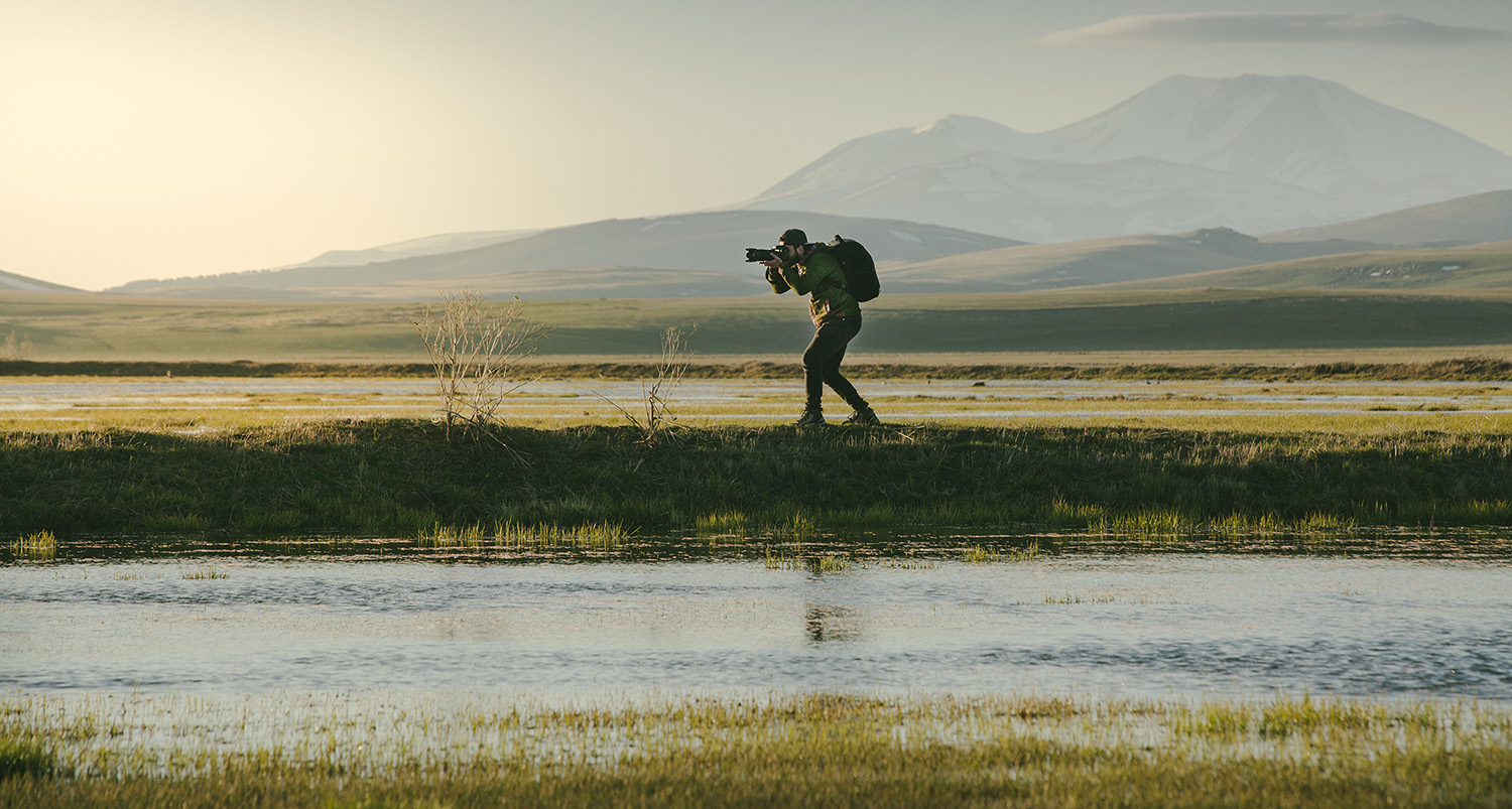
Birdwatching (the main attraction), taking pictures of the landscape, visiting the different lakes, cycling on roads, limited hiking, sport fishing (with a permit), and exploring nearby cultural sites (like Doukhobor villages and Armenian churches) are all things to do.
Accommodation:
- There are no official places to stay in the park, like shelters or bungalows. You might be able to camp in the wild in the right places, but you need to be ready for cold nights and wind and follow Leave No Trace.
- In Akhalkalaki and Ninotsminda towns, as well as in some villages like Gorelovka, Sameba, and Patara Khanchali, there are guesthouses. You can find basic hotels in Akhalkalaki and Ninotsminda.
Amenities:
Akhalkalaki visitor center. Birdwatching infrastructure (towers and platforms) at important lakes. Boards with information. Roads (conditions that change). There are only a few designated picnic areas. There are public toilets mostly at visitor centers and towns. There aren’t many places on the plateau where you can get safe drinking water, so it’s best to bring enough water with you. Akhalkalaki/Ninotsminda has shops, restaurants, and gas stations.
Safety Advice:
- Weather: Even in the summer, be ready for bad weather. Bring layers that are warm (like a hat and gloves) and that won’t get wet or blown away. Because of the high altitude, you need to protect yourself from the sun with sunglasses, sunscreen, and a hat. It can get very cold at night.
- Roads: Check the conditions of the roads in your area, especially the unpaved ones that lead to certain lakes. For exploring off the main roads, a vehicle with more ground clearance is best.
- Altitude: The plateau is high (about 2000m+). If you’re coming from a lower elevation, give yourself time to get used to it.
- Be self-sufficient, especially if you’re going to places that are far away from the main towns. Bring food, plenty of water, gas, and a first-aid kit. The coverage for mobile phones is spotty.
- Border Zone: Be aware of how close you are to state lines. If you need them, get permits and follow all rules and directions from the Border Police.
Park Rules and Regulations
Code of Conduct:
Respect wildlife, especially birds during breeding season (keep your distance and don’t make noise). Stay on the roads or paths that are marked. Follow the Leave No Trace rules (bring back all your trash). Be respectful of private property and local culture, especially farmland and grazing areas.
Prohibitions:
No hunting is allowed. You need a permit and must follow the rules (seasons, species, limits) to fish. It is against the law to bother wildlife, especially bird colonies. It is against the law to drive off of marked roads. It might be hard to start fires because there isn’t enough wood and the winds are strong. Use camping stoves when you can and make sure they are safe. You probably need permission to use a drone. Follow the rules for the border zone exactly.
Conservation and Management
Managing Body:
The Agency of Protected Areas (APA) is in charge of the management of Javakheti National Park. The park’s headquarters are in Akhalkalaki. Park rangers keep an eye on the lake and park reserves.
Conservation Efforts:
The main goal is to protect the unique wetlands and steppes and the many birds that live there. Keeping an eye on bird populations (counting breeding pairs and tracking migration). Helping local communities with sustainable practices like managing grazing and fishing in a responsible way. Managing the effects of visitor infrastructure (towers, platforms) and the infrastructure itself. Efforts to stop poaching. Working together on research.
Threats and Challenges:
Effects of livestock grazing on steppe plants. Illegal or unsustainable fishing and hunting of birds. Changes in the water level and quality of the lakes, which could be caused by climate change or how people use the water. How climate change affects ecosystems at high altitudes. Finding a balance between the needs of tourists and the protection of sensitive bird habitats.
Historical and Cultural Significance
A Brief History:
The Javakheti plateau is a volcanic landscape that is geologically new. People have been grazing animals on it for hundreds of years. Armenians and Russian Doukhobors (a religious group that was exiled here in the 19th century) both settled in the area in large numbers. The Protected Areas system was set up not too long ago, in 2011.
Cultural Importance:
The area has a multicultural history that is one of a kind. Visitors can see Armenian churches, unique Doukhobor villages like Gorelovka with its unique architecture and community history, and signs of traditional livestock farming. The larger Javakheti area has archaeological sites, such as old megalithic structures and fortresses.
Interesting Facts About Javakheti
Unique Features:
- The highest volcanic plateau in Georgia, with lots of lakes and wide grasslands.
- A well-known place around the world for its wide variety of birds, especially water birds (there are many Ramsar sites).
- Has a unique landscape of wetlands and high-altitude steppes that is very different from other parts of Georgia.
- Has a very harsh continental climate, with very cold winters and strong winds.
- There are unique cultural communities here, such as Armenian and Doukhobor heritage sites.
- It is on the border of Armenia and Turkey.
- Lake Paravani, which is in the middle of the region but not in the park, is the biggest lake in Georgia by area.
- A great place for serious birdwatchers to go.
Leave a review