Guria: A Region of Rolling Hills, Tea Plantations, and Distinct Culture
Guria, located in western Georgia along the Black Sea coast, is a region celebrated for its verdant landscapes, unique polyphonic singing tradition, and a history marked by both independence and external influences. Known for its rolling hills, tea and citrus plantations, and a relaxed pace of life, Guria offers a distinct experience within Georgia.
Overview
Guria is an administrative region (mkhare) in Georgia, encompassing the historical-geographic province of the same name. It is a region of diverse natural beauty, stretching from the Black Sea coast to the foothills of the Lesser Caucasus mountains. Guria is particularly famous for its folk music, often featuring the complex and virtuosic “Krimanchuli” yodeling. Agriculture, especially tea and citrus cultivation, has historically been a significant part of its economy.
Geographical Location
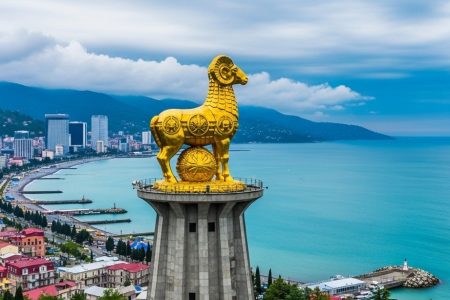
Guria is situated in the southwestern part of Western Georgia. It is bordered by the Samegrelo-Zemo Svaneti region to the north, Imereti to the east, the Autonomous Republic of Adjara to the south, and the Black Sea to the west, with a coastline of approximately 22 kilometers. The region’s topography includes the coastal lowlands, part of the Kolkheti Lowland, and gradually rises into the northern slopes of the Meskheti Range. The main rivers flowing through Guria are the Supsa and Natanebi. The region’s climate is humid subtropical, with warm summers and mild winters, particularly in the coastal areas. Higher elevations experience a more temperate climate. Guria is also home to parts of protected areas, contributing to its rich biodiversity.
History
Guria has a long and rich history, with evidence of human presence dating back to the Lower Paleolithic period. Historically, the territory was part of the ancient kingdoms of Colchis and Egrisi. Guria is first mentioned as a distinct geographic entity in the 8th century. In the feudal period, it developed as a territorial unit within the Kingdom of Georgia, eventually emerging as the autonomous Principality of Guria in the 15th century following the fragmentation of the unified Georgian kingdom. Ruled by the Gurieli dynasty, the principality maintained varying degrees of independence while navigating complex relationships with neighboring Georgian entities and the Ottoman Empire. Guria was eventually annexed by the Russian Empire in 1829. During the Soviet period, Guria was an administrative district and remained an important agricultural area. The region has a history of strong local identity and at times, resistance to external rule.
Population
According to the 2014 census, the population of Guria was 113,350. Estimates from 2023 indicate a population of around 104,338. The population is primarily ethnic Georgian, with a small percentage of Armenians and other ethnic groups. The religious composition is predominantly Georgian Orthodox Christian, with a notable Muslim minority, particularly in areas bordering Adjara. The population is distributed between urban centers, such as the regional capital Ozurgeti, and numerous rural settlements.
Politics
Guria, as a region (mkhare), is part of Georgia’s unitary administrative structure. While regions are not self-governing units, they serve to coordinate communication between the central government and the municipalities within their territory. The central government is represented in the region by a State Representative (Governor) appointed by the Prime Minister. At the local level, governance is carried out by the elected self-governing bodies of the municipalities that constitute the Guria region. These municipal governments, consisting of a Municipal Assembly (Sakrebulo) and a Mayor, are responsible for local administration, budgeting, and the provision of public services within their respective administrative boundaries.
Administrative Divisions
The Guria region is currently divided into three self-governing municipalities: Ozurgeti Municipality, Lanchkhuti Municipality, and Chokhatauri Municipality. The city of Ozurgeti serves as the administrative center of both Ozurgeti Municipality and the wider Guria region. Within these municipalities, there are a number of populated areas, including cities, urban-type settlements (daba), and villages (sopeli), which form the basis of the local administrative structure.